In some African cities, part of the fight against mosquito-borne diseases such as malaria and dengue fever now involves drone surveillance, using the devices to fly over neighborhoods and search for potential mosquito breeding sites. A new “crowd-droning” platform called Globhe is helping connect governments to drone pilots to fly these missions, building detailed maps for public health; in the case of mosquitoes, the system can help the government find problem spots more quickly.
Globhe CEO Helena Samsioe started the company after seeing freelance drone pilots working on photography projects for publications such as National Geographic. “When I lived in Zambia, I realized that this photography can be used in data as well, not just beautiful pictures,” she says. “I started to connect drone pilots who wanted to contribute and be part of providing social impact around the world.”
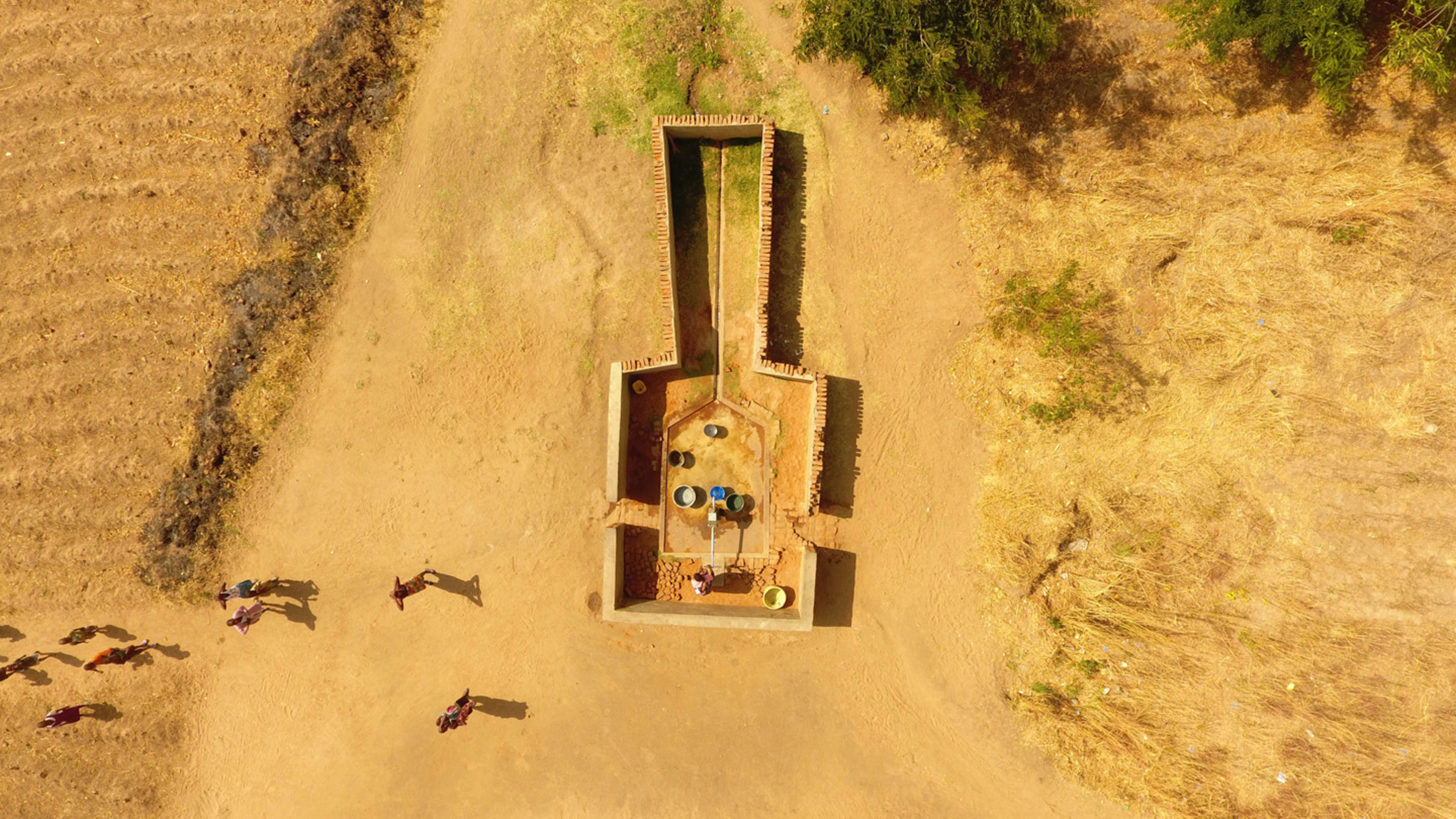
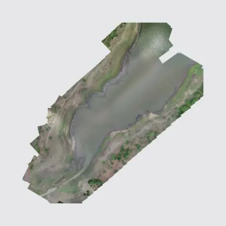
Drone photos can give public health agencies information that they couldn’t easily get otherwise, including detailed estimates of population data that are critical to have in the case of a disease outbreak or to plan a campaign to deliver vaccines. Each flight yields more than 1,000 (and sometimes as many as 10,000) photos that can be stitched together into a digital map.
“It looks like a Google map, but it’s in real time and it’s a much higher image quality,” Samsioe says. “You can zoom in to a much higher degree. The drone photos give much more detailed information than satellite imagery.” The most recent satellite images are also often out-of-date, especially in parts of Africa.
In current work in Malawi and near Lake Victoria, drones are mapping mosquito breeding sites—the bugs like standing water or muddy areas—so that the government can send crews to spray targeted areas. “They can make sure that they control and spray those areas instead of just spraying all over the place, which would be bad for the environment, would cost more, and it would also be bad for the people that live there,” she says. “It’s a tool to be able to more efficiently respond and prevent malaria outbreaks.”
[Photo: courtesy Above]
Globally, malaria kills more than 400,000 people a year, most of whom are children under the age of five living in Africa. There are a variety of ways to tackle the disease, including mass use of bed nets doused in insecticide, a new (and only partially effective) vaccine, and even gene-editing mosquitoes to make their offspring die (experiments with this have gone awry; when some mosquitoes gene-edited to stop the spread of dengue and Zika were released in Brazil, they managed to spread new genes to the local population, possibly making them stronger). Finding and spraying mosquito breeding sites is another approach.
Drone photos can also be used to map and better understand neighborhoods. In Malawi, for example, drones captured images of streets, and the team later used artificial intelligence to count the number of houses; the government was able to estimate the population based on average household size. Some other groups may use drone photos to build detailed maps in areas where formal street addresses don’t exist. Drone photos can also be used after disasters such as hurricanes or floods to track damage and see where help is needed. Globhe is currently working with academic researchers to study how effectively the introduction of drones in various public health issues can help reduce infections and deaths.
Globhe has been working with drone pilots since 2015, but the new platform, built along with the Swedish design agency Above, is designed to help the project scale up. A government or nonprofit anywhere in the world can put in a request on the platform, local freelance drone pilots on the platform will be notified, and when they have the images, they can quickly be uploaded to the platform and delivered to the client. “It’s pretty much making [accessing] drone maps as easy as it is to order an Uber,” Samsioe says.
Recognize your brand’s excellence by applying to this year’s Brands That Matter Awards before the early-rate deadline, May 3.
