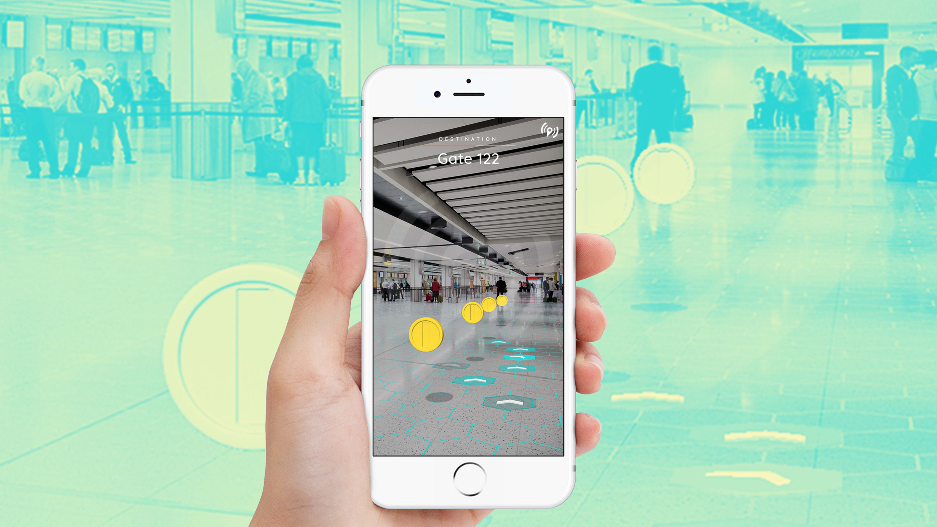
There are coins floating in the air in the new West Kowloon Cultural District in Hong Kong. A ground-up development on about 100 acres of reclaimed land, the district features a major new art museum, a performance and convention center, a large park, hotels, offices, residences, and several cafés, restaurants, and shops. It’s a massive urban development adding up to millions of square feet of real estate in the dense city. The floating coins, seen through an augmented reality app, are part of a new way of getting around the space.
Developed by the navigation company Pointr, the AR app is one element of a digital map that’s attempting to encapsulate this complex and dynamic urban environment. To walk from one part of the district to another, or even to navigate from one part of a building to an exhibition on another floor, Pointr’s AR map lays a trail of coins on a user’s phone screen. Walking along the path, they’ll be able to get from point A to point B without getting hopelessly lost.
“AR is the simplest way to show someone the way,” says Ege Akpinar, Pointr’s founder and CEO.
Though digital maps are no new idea and nearly any smartphone user has opened an app like Google Maps to see where they are and where they’re going, these maps have limitations because they rely on GPS.
Another shortcoming of GPS is that it can’t differentiate between levels. “It’s one level for the whole world,” Akpinar says. That poses navigation challenges for buildings in dense, high-rise cities like Hong Kong, London, or New York. Pointr’s technology offers a more granular solution for those types of spaces.
Pointr’s app can be used to navigate between and within buildings. The Xiqu Centre, a performance venue and exhibition hall for traditional Chinese theater, is one of the central buildings in the district. Its multiple performance spaces are scattered inside a 300,000-square-foot building with a large atrium at its center. Ramps and escalators connect spaces within, blurring the boundaries between its eight floors.
“When you have this fluid space, with ramps going up, it’s even difficult for us to describe which floor you’re on,” Akpinar says. Pointr’s technology uses internet-connected sensors installed throughout the building and elsewhere to provide precise location data, showing users that a performance is up two ramps and to the east, for example. “It’s one of the most difficult deployments we’ve done.”
A growing customer base is airlines and airports. In one deployment, Pointr replaced the coins in the AR navigation app with an image of an airplane. As users navigate their way across the terminal, the airplane image is just ahead, directing them through the complicated airport environment until they finally get to their gate. “You’re literally catching your flight,” Akpinar says.
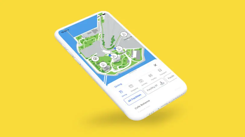
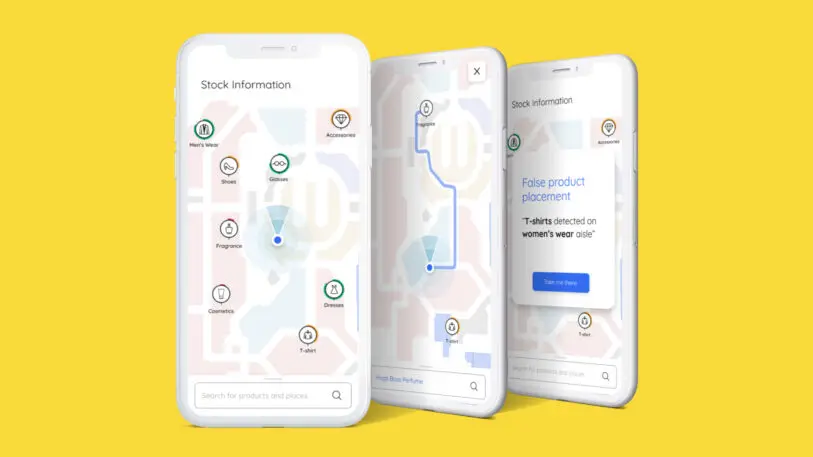
The maps Pointr created for the West Kowloon Cultural District show how dense and complex urban spaces may need new kinds of navigational tools. Akpinar concedes that spaces like airports or malls have their own physical maps that can guide people around, but he argues that Pointr’s maps can be more reactive to the ways these environments change. Maps can be updated nearly in real time, showing where the latest exhibition is on display or where there’s a sale in a department store.
Akpinar isn’t trying to replace Google Maps. Instead, his company is offering a technology that augments the way we navigate using digital maps today. “In a supermarket, in a stadium, in an airport, in a museum or a cultural institution like West Kowloon,” he says, “people will get used to it being so easy for them to access this information that this will become standard.”
Recognize your brand’s excellence by applying to this year’s Brands That Matter Awards before the early-rate deadline, May 3.