Nicosia, the capital city of Cyprus, has been divided between the island nation’s Greek and Turkish communities for nearly 50 years. A new public park built along a historic dividing line aims to help reconnect the city and the country.
[Photo: /courtesy Zaha Hadid Architects]Designed by Zaha Hadid Architects, Eleftheria Square is a broad public plaza and park featuring gardens, playgrounds, fountains, a viewing platform, and the kind of wide-open spaces where strangers can coexist.
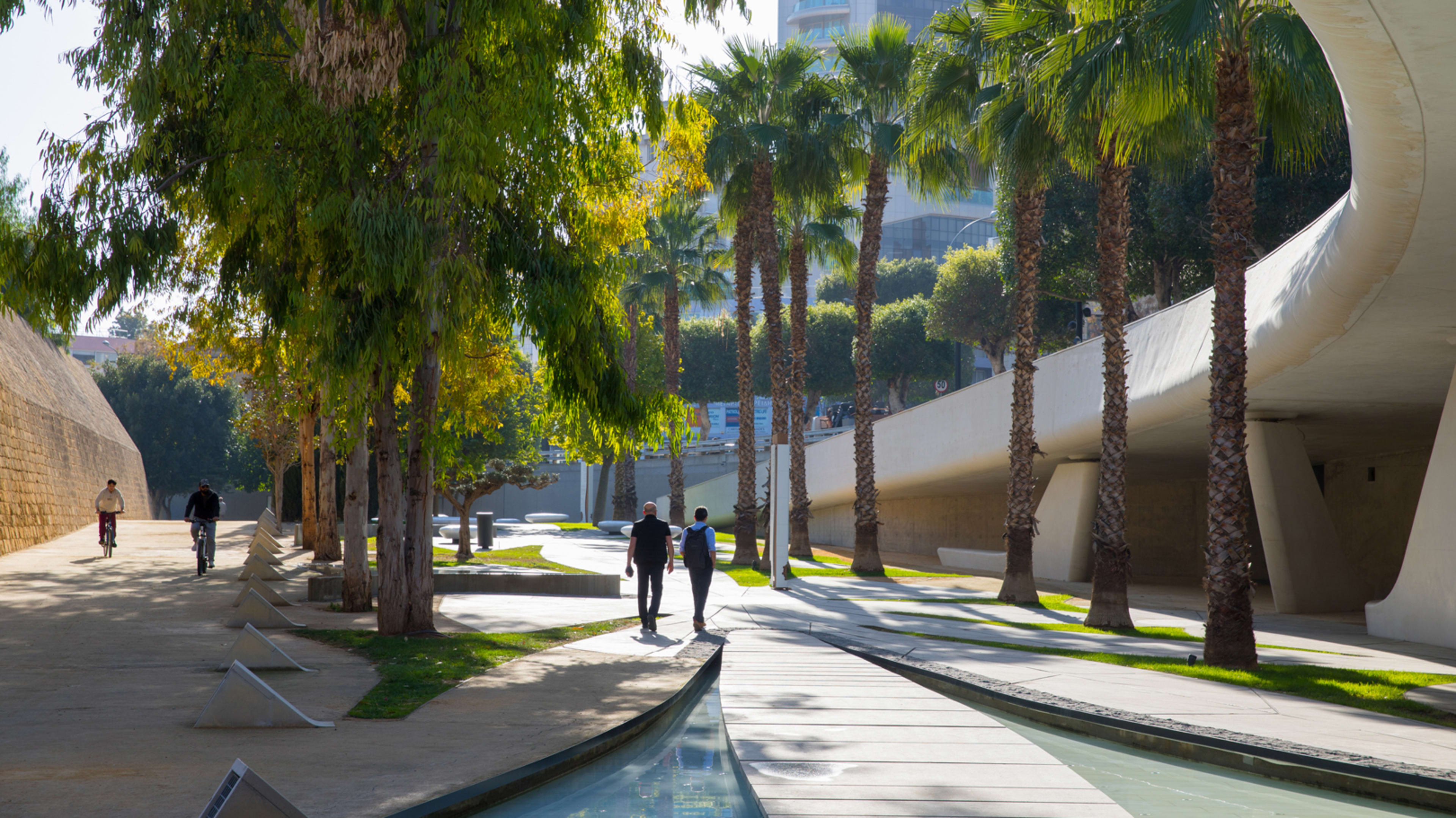
[Photo: /courtesy Zaha Hadid Architects]Funded primarily by the European Union at a cost of about $45 million, the park exists on two levels. The top level is a former bridge connecting the old city to the new, where vehicular lanes have been removed and the entire space extended out as a pedestrian zone. Below sits a linear park, with sculptural elements and a large hardscape made up of bending and sinuous shapes interspersed with gardens. In total, the public square adds up to five acres of largely pedestrian-only park space.[Photo: Laurian Ghinitoiu/courtesy Zaha Hadid Architects]The park sits at the site of key physical divisions in the city and the country. A buffer zone, calledthe Green Line, has stretched 100 miles across the island and directly through the city of Nicosia since 1974, cutting off streets and slicing in half the historic walled city that was once Nicosia’s center. The new park is located just south of this buffer zone, along the earlier dividing line of the defensive walls and moats built around the city center in the Middle Ages.
[Photo: /courtesy Zaha Hadid Architects]The design of Eleftheria Square seeks to reframe this historic space of division—and to provoke new thinking about the contemporary dividing line nearby, according to Christos Passas, an architect at Zaha Hadid Architects who led the design.
After several delays in construction, the budget ballooned to at least $45 million. The former bridge opened to the public in 2018, and the park space below on the dry moat was inaugurated in December. The park is now fully open to the public.
[Photo: Laurian Ghinitoiu/courtesy Zaha Hadid Architects]Some critics see a missed opportunity.Socrates Stratis, an associate professor of architecture at the University of Cyprus, calls the park a “Potemkin corridor,” arguing in an email toFast Companythat “the change involves utterly photogenic, sculptural yet sterile structures.”
[Photo: Laurian Ghinitoiu/courtesy Zaha Hadid Architects]The park, Stratis says, “offers a branding image for real estate investment in the area. I would expect something more than that.”
[Photo: Laurian Ghinitoiu/courtesy Zaha Hadid Architects]Down on the former dry moat, Stratis says there’s room for improvement. Stratis says it is too busy, and without the kind of gathering spaces or even protest grounds other public spaces offer. “To my regret, the ground of the moat is utterly fragmented by all sorts of lavish structures that leave no room for democratic practices yet look nice from Google Earth,” he says.[Photo: Laurian Ghinitoiu/courtesy Zaha Hadid Architects]He says the successful parts of the project square are those where car space has been turned over to pedestrians, a product of citizen participation in the planning process. “The citizens have helped the project to avoid partially the pitfall of the dominance of the private car,” Stratis says.
Passas says the park can’t single-handedly undo the divisions that have plagued the country for decades, but he’s hopeful that it can be a visible starting point. “It makes a symbolic statement about what the reunification of the island could be,” he says.
Recognize your brand’s excellence by applying to this year’s Brands That Matter Awards before the final deadline, June 7.
Sign up for Brands That Matter notifications here.
The latest innovations in design brought to you every weekday.