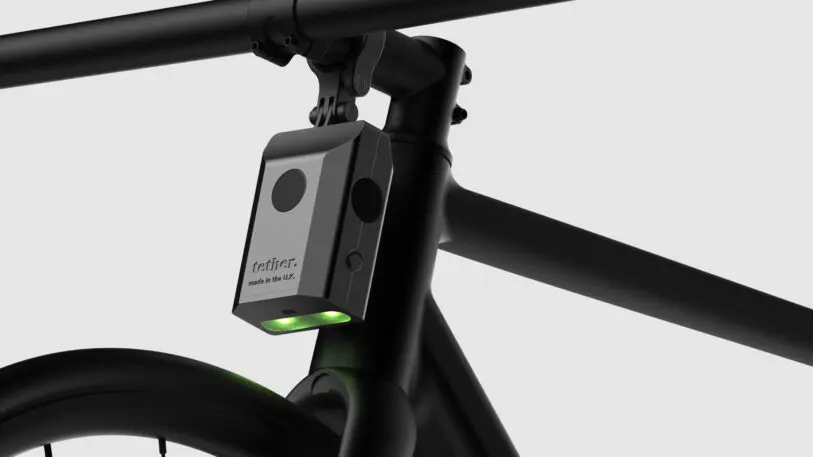
Tether is both a bike light that shines a ‘safe zone’ to keep drivers at a distance, and a sensor that records data on which roads cars tend to get dangerously close to cyclists.
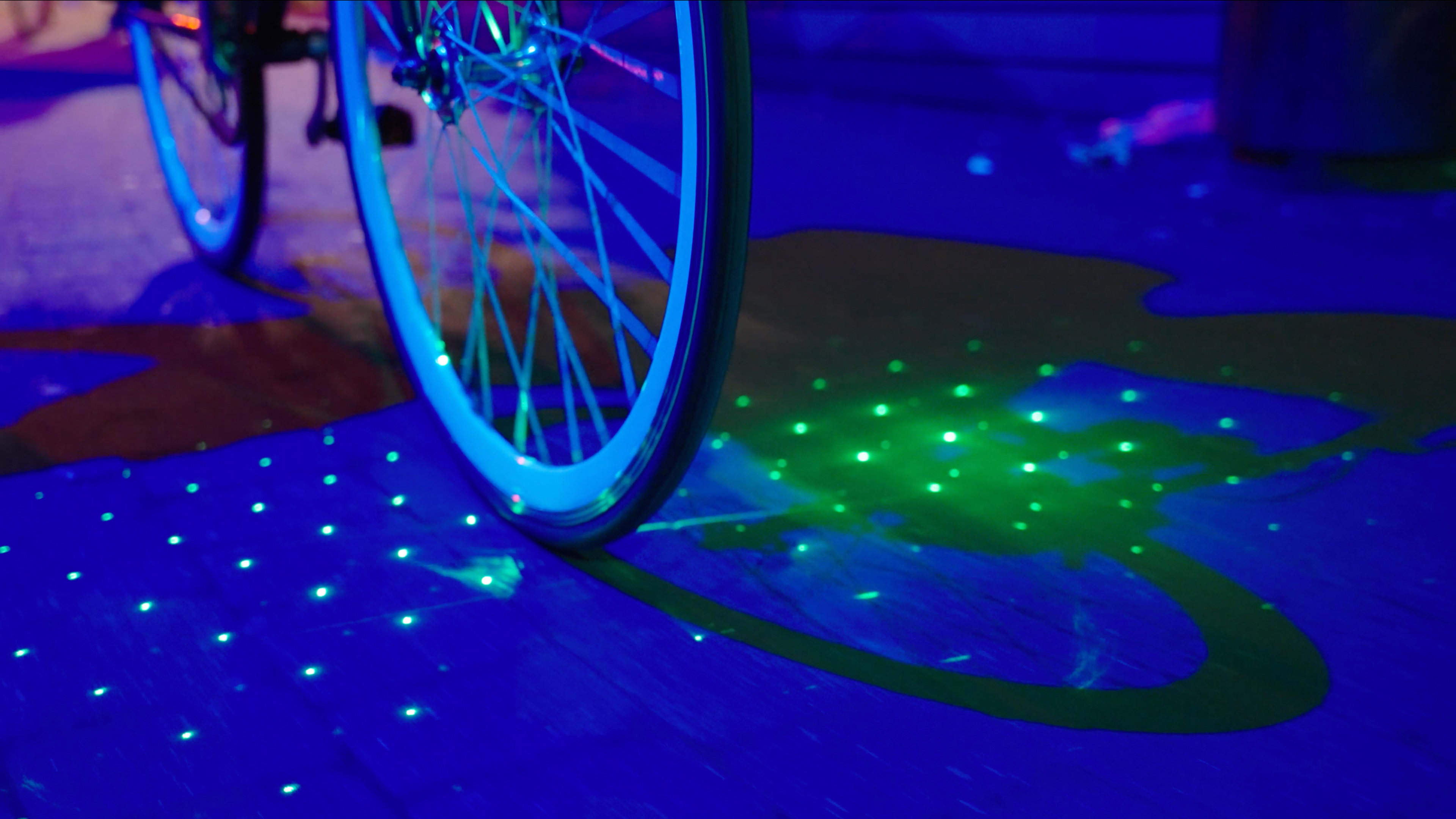
When product designer Omar Bakhshi bikes home from work in London, a small device mounted on his handlebars projects a grid of bright dots on the road to remind drivers to stay a safe distance away. When a driver gets too close, the lights flash—and sensors inside the device record the location, adding to a crowdsourced map in an app that other cyclists can use to see which roads are most dangerous.
[Image: Tether]“What we set out to do was try and create more of a movement or a community through a connected product,” says Bakhshi, founder of Tether, the startup that designed the device. “This data doesn’t really exist at the moment . . . you can’t actually see where the safe and unsafe roads are.” While some other bike lights are designed to also keep drivers at a distance by projecting laser “bike lanes,” or an image of a bike that warns drivers that a cyclist is approaching, the Tether aims to do more, collecting data about where drivers are unsafe, how close they get, and how much they’re speeding when they pass.
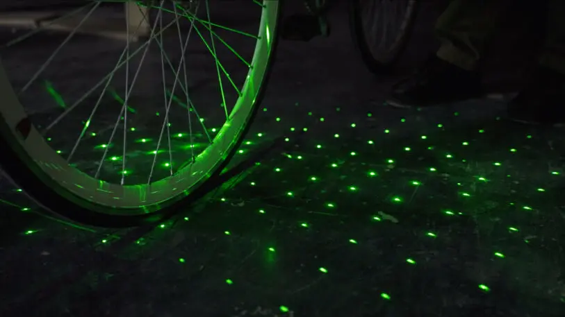
[Photo: Tether]London, like many cities, has been quickly adding new bike lanes: Between May 2016 and March 2021, the city installed160 milesof what it calls “high-quality cycle routes,” 62 miles of which were added since the pandemic began. More are in planning, including oncar-free streets. Still, if some bike paths just have a strip of paint and aren’t fully separated from cars by a barrier, they can be dangerous. As more people started riding bikes in London during the pandemic—and drivers sped more often—more cyclistswere hit and seriously injured by cars.
[Photo: Tether]The problem may be less about visibility and more about a lack of empathy, Bakhshi says. An Australian study found that drivers oftendehumanizepeople on bikes. “It’s not that they haven’t seen the cyclist, it’s that they don’t care about the cyclist,” he says. He believes that the “bubble” of light projected from the device may be able to change drivers’ attitudes. Later iterations of the device may include more variation that allows for communication—a cyclist could potentially push a button to project a heart on the street to thank a driver for giving ample space. The lights also help remind cyclists to give themselves extra space, he says.
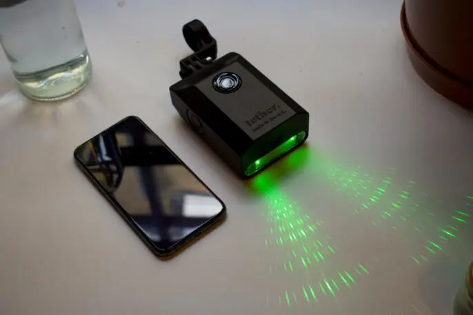
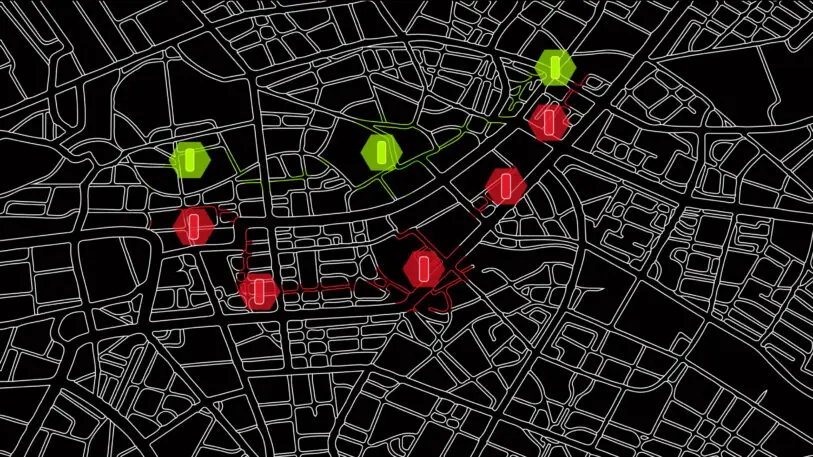
[Photo: Tether]The data gathered by the sensors can help cyclists find safer routes now, and then can be used by planners to help prioritize where streets most need to be redesigned. Though the work is at an early stage, the company plans to share data with the government so it can make the best choices. The U.K. government plans to spend1 billion poundson new bike and pedestrian infrastructure. “Where do you put those new cycle lanes? What roads do you close down to car traffic?” Bakhshi says.[Photo: Tether]The team has been testing the device with beta users over the last several months, making tweaks so that it’s possible to tell, for example, when someone is riding past a bus, versus a bus closely passing them. The beta device, which the team plans to manufacture in the U.K. to avoid supply-chain delays is currentlycrowdfunding on Kickstarter. Initially, it will be available only in the U.K., so the startup can offer quick customer service. But it could be useful in any city where bikes and cars are in conflict.
Recognize your brand’s excellence by applying to this year’s Brands That Matter Awards before the early-rate deadline, May 3.
A refreshed look at leadership from the desk of CEO and chief content officer Stephanie Mehta