Greg Foltz gaped at the violent footage. A chief scientist with the National Oceanic and Atmospheric Administration (NOAA), he’d spent most of the previous night glued to his computer monitor, anxiously following the data streaming from the first surface drone to drive into a raging cyclone.
Then the images appeared. Deep within the bowels of Hurricane Sam, less than 35 miles northeast of its eye, a torrent of 50-foot waves and fierce 120-mph winds pummeled the camera, spitting frenzied sea spray against a dark and menacing sky. It was Mother Nature at her angriest—and Foltz couldn’t be happier.
“I got chills when I saw those first pictures,” says Foltz, from NOAA’s Atlantic Oceanographic and Meteorological Laboratory in Miami. “I had never seen anything like that from the surface of the ocean. And to see those 50-foot wave faces and the power of the wind and air, that was the most exciting part. It was more extreme than I imagined it would be. I was just in awe.”

The unprecedented footage, taken Thursday morning from a spot some 700 miles northeast of Puerto Rico, marked the first time scientists successfully sent an uncrewed ocean surface drone into a major hurricane—a Category 4 one, at that—to gather and transmit video and environmental data in situ. The probe remained in the storm for four hours before being outpaced, capping a seven-year collaboration between NOAA and Saildrone, a San Francisco-area company that manufactures autonomous surface vehicles for marine data collection.
“This couldn’t have gone better,” says Saildrone founder and CEO Richard Jenkins. “It was a high-risk mission in that we were doing this for the first time in a wild environment. The value of the data was so great, we were prepared to lose a vehicle. But for it to sail through this incredibly powerful storm, and come out unscathed with the data, is better than we could have hoped.”
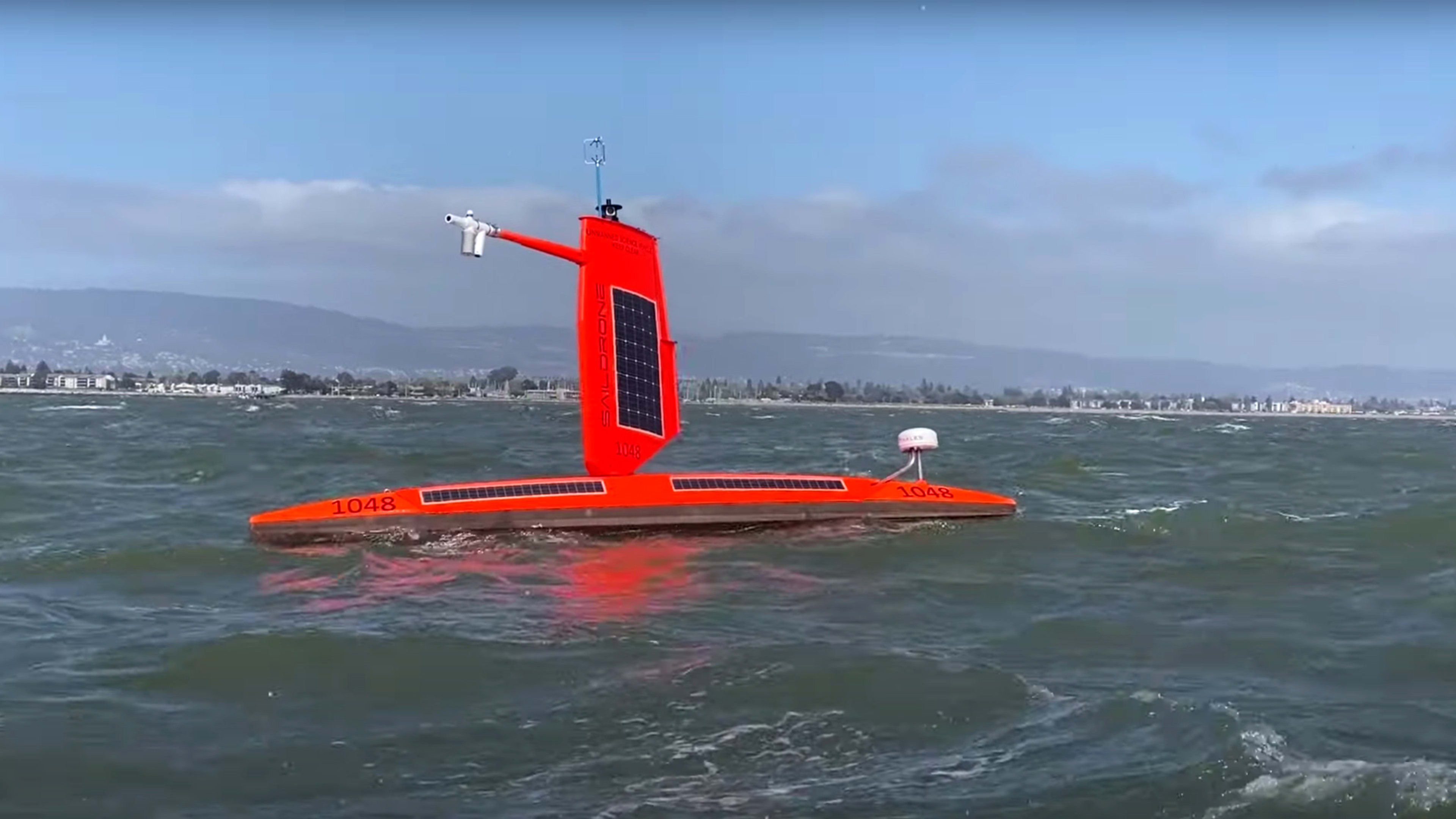
This latest mission, which NOAA funded for roughly $1.2 million, began in June when Saildrone released a fleet of five 23-foot solar- and wind-powered Explorer probes. The drones were modified with special stabilizing “hurricane wings” before sailing into Florida, Puerto Rico, and Caribbean waters to collect more definitive information on the physical processes of hurricanes and real-time observations for prediction models. Researchers hope the data will offer new insights into how large and destructive such storms will become as climate change progresses, with a goal of improving forecasting and preparedness, especially in coastal communities. The fleet will continue for another three weeks, with NOAA posting its findings in its observations viewer.
How to measure a hurricane
Conventional methods of hurricane data-gathering include reconnaissance aircraft, dropping instruments into storms, and floating sensors that bob between the surface and depths. But the guided Saildrone surface probes’ precise positioning enables more nuanced on-site readings of surface temperature, salinity, humidity, evaporation, wave velocity, and currents. Eventually, the team wants to develop sensor technology that will measure sea spray, foam, and air bubbles to ascertain how those impact the transfer of energy between the wind and waves.
“We could actually direct the Saildrone to where the hurricane was going to be, which is something new,” says Foltz. This helps scientists study how wind and water temperature contribute to a hurricane intensifying. “Being at the surface of the ocean is very important—that’s the engine of the hurricane.”
The warmer the ocean, the higher the hurricane’s potential wind speed. That’s because hurricanes intensify by extracting energy from warm water. But the ocean also slows the winds down through drag, so the maximum potential intensity that a hurricane can reach largely depends on the balance of these two forces.
Saildrone and NOAA have previously run joint excursions to the Pacific, Arctic, and Southern (Antarctic) oceans to gather atmospheric and oceanic data, including air temperature & relative humidity, wind speed and direction, and water salinity and temperature. But tackling a hurricane meant redesigning the sensors to operate in and survive even more extreme conditions.
The major change involved downsizing the “wing,” a carbon-fiber composite sail that also houses the solar panels and instruments. Saildrone engineers shortened its height from 16 to 10 feet and lowered its center of gravity, so it could survive the forces of the wind and waves. The team toughened the sensor components and housings to take the additional punishment, adding redundant technology as a backup. Saildrone upgraded the drone’s modem for improved satellite connectivity. “That’s how we got the video back,” says Meinig.
The team also tested coordinated sampling with underwater gliders, smaller robots that can collect and transmit environmental data from the surface to depths of 3,300 feet.
A perfect storm
The scientists decided to target Sam on September 20, after they spotted it forming in the middle of the Atlantic Ocean where it was unlikely to reach land, providing an ideal research scenario.
“We looked a week ahead of time to see where Sam would go, hung out in that area, and fine-tuned it to hit the Northeast quadrant of the tropical cyclone, where it’s strongest,” Meinig adds.
This winter, NOAA will present its findings from Hurricane Sam and the rest of the Saildrone mission in the Atlantic at the American Geophysical Union and American Meteorological Society conferences, while Saildrone plans an expanded 10-drone fleet for next year’s hurricane season.
Still, considerable work remains for this season, as the scientists measure post-storm temperatures and salinity to gauge the amount of heat Sam drew out of the ocean. Saline layering can trap heat below the surface, raising questions about its contribution to how a hurricane grows. “We want to see what mixing those layers in a hurricane can mean for the intensification process,” says Meinig. “From there, the science will present more questions.”
Recognize your brand’s excellence by applying to this year’s Brands That Matter Awards before the final deadline, June 7.
Sign up for Brands That Matter notifications here.
