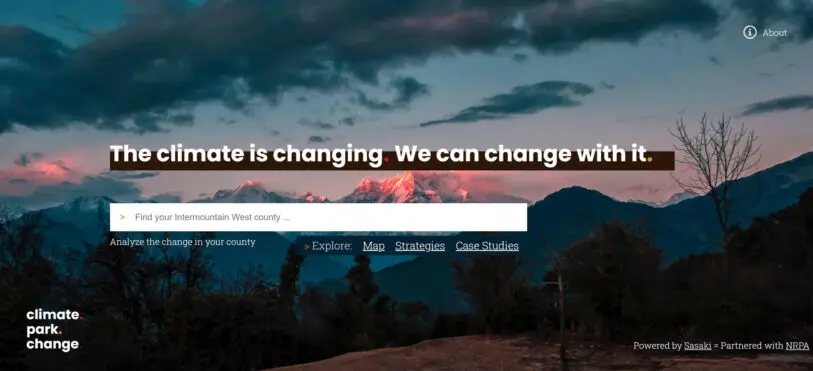
If you live in Denver and you think about the local impact of climate change, your first thought might be about wildfires: The city saw weeks of air-quality alerts last year as it was blanketed in smoke from nearby fires. But the list of impacts is longer. There will be more extreme precipitation, followed by extended drought in the area. There will also be more extreme winds, erosion, water-quality issues, smog, invasive species, heat waves, flooding, and a shrinking snowpack. The city regularly shows up on lists of the best places to live. But like virtually everywhere in the U.S., climate change is threatening that livability.
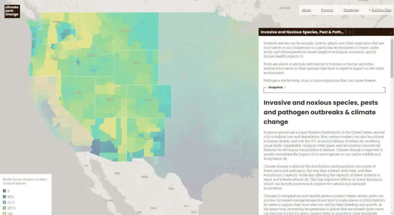
[Image: courtesy Sasaki]Climate change looks different everywhere. A new interactive map shows a detailed list of likely impacts by county, starting with the Intermountain West, the region bounded by the Rocky Mountains on the east and the Cascades and Sierras on the west. The tool was designed specifically for people who manage parks, and includes strategies for dealing with each impact within city and county parks. But it’s also useful for anyone who wants to better understand how an area is changing.
[Image: courtesy Sasaki]“We want to make sure that it’s accessible for the general public,” says Anna Cawrse, a landscape architect at the design firm Sasaki, which built the platform, calledClimate.Park.Change, through an internal grant, working in partnership with the National Recreation and Park Association. “One of our goals was to make sure that this website was pretty user friendly. A lot of times when we talk about climate change, you can pretty quickly get very academic.”
The platform includes detailed information about each impact and its links to climate change, as well as a plethora of outside sources. But it’s also simple to quickly see which risks are biggest locally and to begin to think about potential changes, like swapping out a lawn for drought-resistant native plants in a region dealing with increasing drought.
Click here for a larger version. [Image: courtesy Sasaki]While a lot of thinking about how to redesign cities for climate change has focused on coastal areas facing challenges from rising seas and stronger hurricanes, the team was interested in starting with several Western states that get less attention. “There’s a pretty good cross section of strategies that could be applied in other parts of the country,” Cawrse says. “And the hope is that as additional funding would come in, we would be able to grow this from the center of the country out to the coasts, where there is a larger body of research.”
Recognize your brand’s excellence by applying to this year’s Brands That Matter Awards before the early-rate deadline, May 3.
A refreshed look at leadership from the desk of CEO and chief content officer Stephanie Mehta