Fast company logo
|
advertisement

886 amphibians, 436 birds, and 376 mammals could lose so much habitat that they would be at much higher risk of extinction.

Human land use is going to threaten 1,700 species with extinction in the next half century

An endangered Nile Lechwe in captivity. [Photo: DannyIacob/iStock]

BY Adele Peters1 minute read

In 50 years, as cities, farms, and other development continues to sprawl into wildlife habitat around the world, 1,700 species will be at greater risk of extinction, says a new study from Yale ecologists.

“We’re finding a really dire picture,” says Walter Jetz, a professor of ecology and evolutionary biology at the Yale School of Forestry & Environmental Studies, and coauthor of the paper, published today in Nature Climate Change. “We were able to identify some of the hotspots of future biodiversity impact purely from expected land use changes, and we found thousands of species that we really need to worry about.”

The researchers looked at four different scenarios for human land use–based on population growth and economic changes–and then compared that to the geographic range of 19,400 species. Under a middle-of-the-road scenario, 886 amphibians, 436 birds, and 376 mammals would lose so much habitat that they would be at much higher risk of extinction.

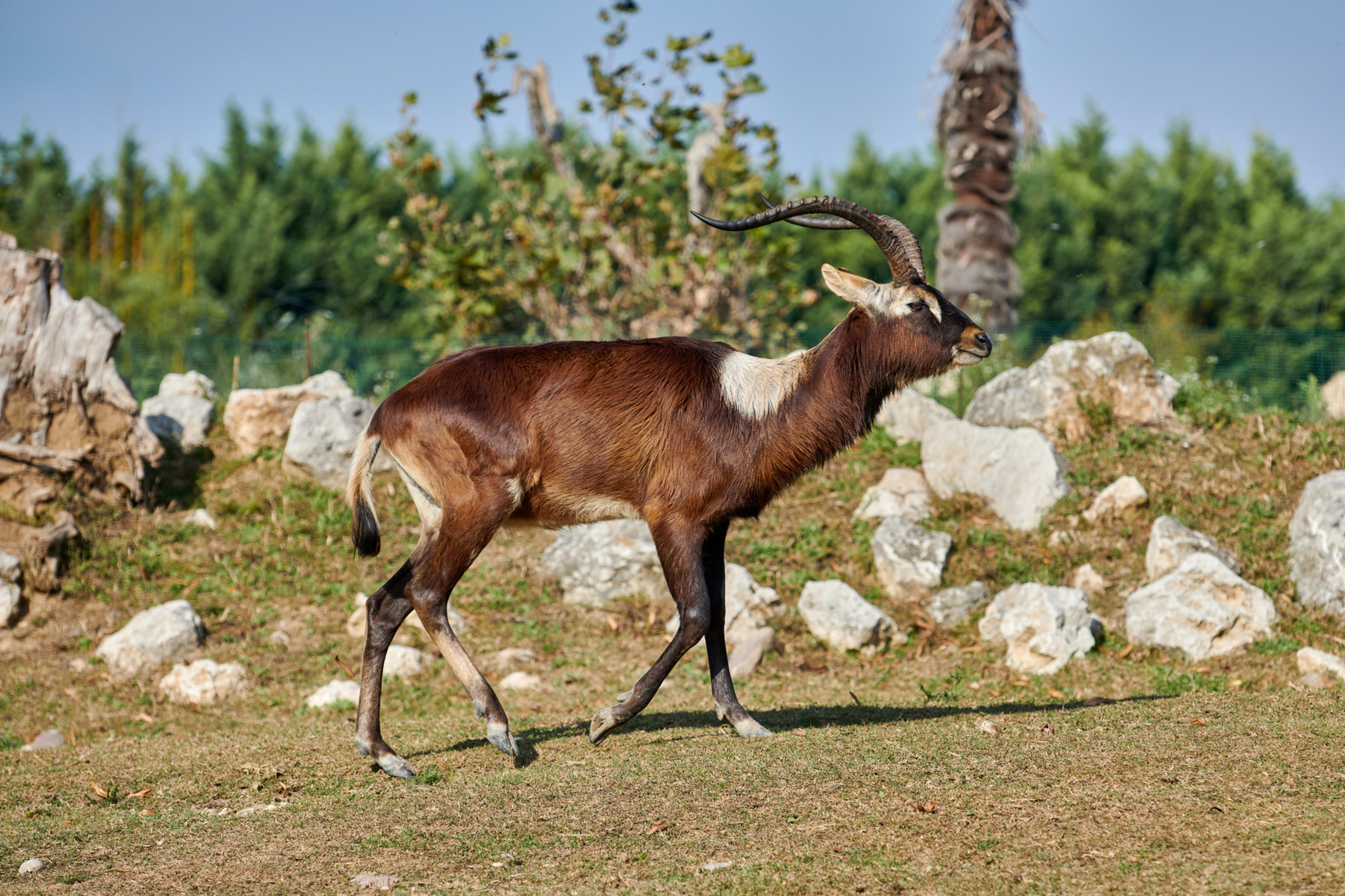
In Africa, for example, a species of antelope called the Nile lechwe currently lives in parts of Sudan and Ethiopia. But in that corner of East Africa, open space is quickly transforming to relatively intensive agriculture, partly to supply markets in China or in Saudi Arabia, where investors have been buying up African farmland for several years. Local economic growth is also bringing more development into open space. The antelope, which is already endangered now, could see its range shrink by more than half. That’s a risk on top of those that animals face directly from climate change, such as increasing heat and drought.

advertisement

[Screenshot: Map of Life]
On a new website calledMap of Life, the researchers share detailed information about the species they studied. Maps powered by Google Earth Engine show what might happen to their habitat under various scenarios. “Anybody can look at this and assess and then use it in their decision-making regionally,” Jetz says. That includes both governments planning development and the companies whose supply chains drift into natural areas to grow crops like palm oil–for use in everything from shampoo to instant noodles–orcocoa farms driving deforestation in Africato make chocolate. The maps show the impact on species at a kilometer-scale resolution. “That’s actually at the scale where management decisions that can happen,” he says. “I think that’s what is really powerful about this research.”

Recognize your brand’s excellence by applying to this year’s Brands That Matter Awards before the early-rate deadline, May 3.

ModernCEO Newsletter logo
A refreshed look at leadership from the desk of CEO and chief content officer Stephanie Mehta
This site is protected by reCAPTCHA and the Google Privacy Policy and Terms of Service apply.
Privacy Policy

ABOUT THE AUTHOR

Adele Peters is a senior writer at Fast Company who focuses on solutions to climate change and other global challenges, interviewing leaders from Al Gore and Bill Gates to emerging climate tech entrepreneurs like Mary Yap. She contributed to the bestselling book "Worldchanging: A User's Guide for the 21st Century" and a new book from Harvard's Joint Center for Housing Studies called State of Housing Design 2023 More


Explore Topics