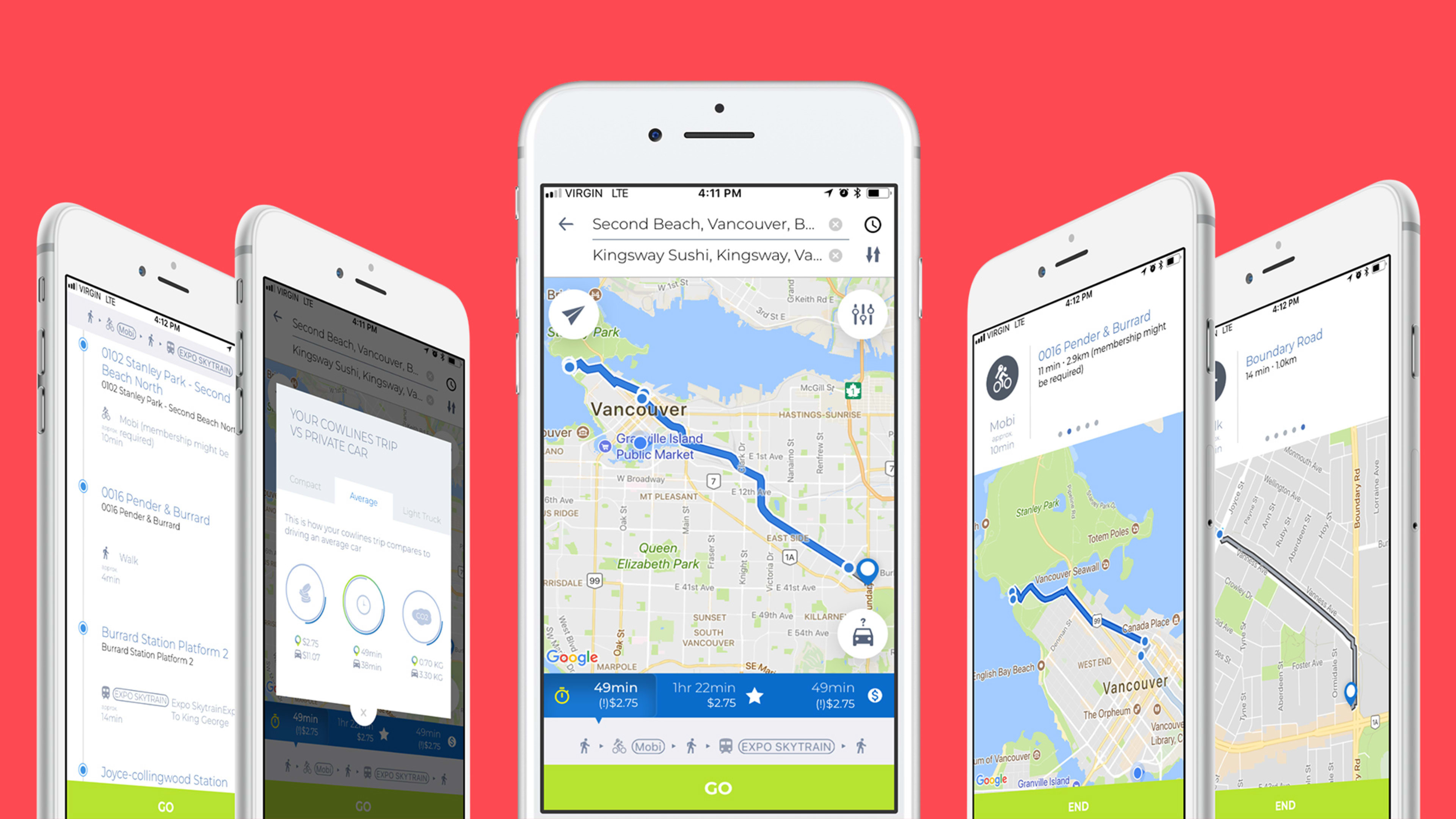
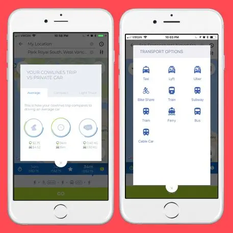
Type your commute into a new app, and it will tell you the fastest way to get there using essentially every local transportation option available–from the subway to a bike to Uber to a water taxi or a bus–and the carbon footprint, cost, and length of that trip versus driving in your own car.
“We’re trying to get people–in a clever, smart way–out of cars, plain and simple,” says Jonathan Whitworth, co-owner and chief strategy officer of Greenlines Technology, the company that created the app, called Cowlines. (The name, used in urban planning circles, refers to the fact that cows in an open field will choose the most efficient route to walk home.) “We want to help reduce greenhouse gas emissions.”
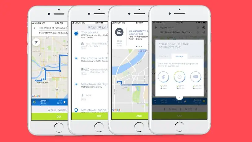
Because Cowlines considers multiple modes at once, unlike an app like Google Maps, it can identify faster routes. “The combination gets you from A to B, in most cases, much quicker than what traditional Google Maps or another app will provide,” says Whitworth. “We’ve even seen in some of the tests that we’ve done that it’s sometimes up to 50% faster.”
[Image: Greenlines Technology]
The iOS app, which was piloted in Vancouver earlier this year, is now available in 62 cities in the U.S. and Canada, including New York City, Los Angeles, San Francisco, and Seattle. It’s free to use. Greenline Technologies plans to sell aggregated, anonymized data to city planners who can use it to improve local transportation. Right now, cities might know how many people board a bus at a particular stop, but don’t know where those commuters came from or are going. “They’re starving for that information,” says Whitworth. If commuters are going from the bus to bike share, for example, the city might decide to add a bike lane in the area.
In some cities, such as Portland, Oregon, the app pulls data (primarily in real time) from as many as 50 different providers. But Whitworth says that the process of adding new cities is relatively fast. Ultimately, the company plans to make the app available globally. “We just want to follow the numbers,” he says. “When you see a city like Delhi that has the same population of Canada–around 30 million people–the numbers start becoming mind-bogglingly good about how by using our app you can get people to think about the decisions they’re making.”
Recognize your brand’s excellence by applying to this year’s Brands That Matter Awards before the early-rate deadline, May 3.
