Update Monday, July 17, 2023
Due to wildfires still raging in Canada, the National Weather Service has once again issued an air-quality warning for parts of the United States in what is turning out to be a smoky summer for millions of Americans. This time, it’s the Great Lakes region, the Midwest, and the High Plains that are being put on alert.
Affected states include Montana, South Dakota, Iowa, Minnesota, Illinois, and Indiana, CBS News reports. These warnings come about five weeks after smoke engulfed much of the Northeast and New York City in early June, also the result of Canadian wildfires. We’ve rounded up sources below that let you track the wildfires, smoke, and air quality via maps and other tracking tools.
Original story:
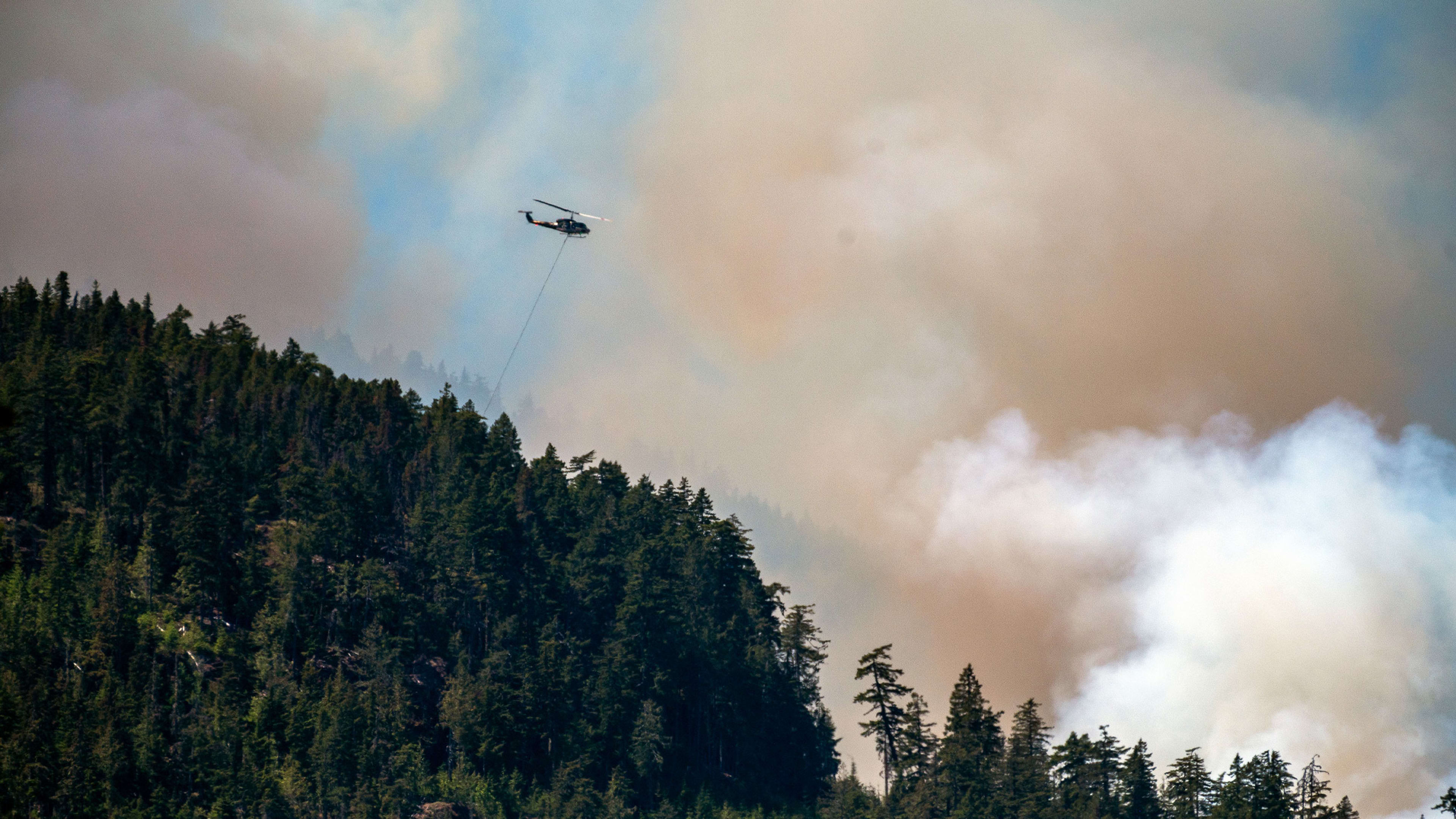
If you’re in the northern United States, particularly on the eastern border around New York and Michigan, you’ve probably noticed that the sky is pretty hazy-looking, if not downright smokey. That’s due to numerous wildfires raging across eastern Canada. The destructive fires are sending their smoke southwards toward the border, resulting in an atmospheric haze.
But far from just being a visual annoyance, the smoke poses a safety risk to residents in certain parts of the United States. Indeed, as the New York Times reports, all of New York City is under an air-quality alert due to the smoke, with Mayor Eric Adams declaring parts of the city to have “very unhealthy” air quality. That air-quality warning follows warnings in other American cities, including Chicago and Philadelphia.
The cause of the smoke and haze isn’t just one wildfire in eastern Canada but thousands of them. Two maps give a particularly good idea of where the wildfires are located and how close they are to the United States.
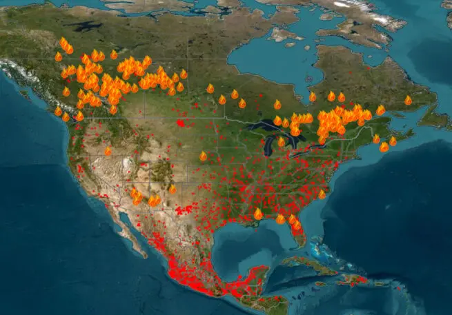
The first map is the Fire Information for Resource Management Systems map that uses data from NASA and the Forest Service of the United States Department of Agriculture. You can see from this map that wildfires are spread across Canada’s west and east. But it’s the eastern fires, which lie closer to the U.S. border, that are causing most of the atmospheric disturbance in cities across the United States.
A nice feature of this map, by the way, is the timeline function, which allows you to see how the wildfires have spread over the past several days.
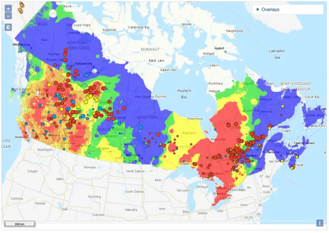
The second map uses data from the Canadian Wildland Fire Information System. This interactive map color codes parts of Canada to show where the fire danger is the most extreme and to show where fires are still raging out of control.
The red patches of areas on the map are the worst. These are areas where the fire danger is labeled as “extreme,” which the Canadian Wildland Fire Information System defines as “Fast-spreading, high-intensity crown fire. Very difficult to control. Suppression actions limited to flanks, with only indirect actions possible against the fire’s head.”
The map also displays color-coded circles. Again, the red circles are the most dire as they signify active fires that are labeled as “out of control.” The larger the circle, the more hectares that are on fire, with the largest circles signifying more than 1,000 hectares are on fire.
This summer’s wildfire season in Canada is expected to be the worst ever, reports Reuters. How long will the smoke affect U.S. cities? That depends on which city you are talking about and how well fire services can get the current fires under control. But as for New York City, local news station WABC says it won’t be today, but the city could “maybe” see some clearing by Thursday or Friday.
Recognize your brand’s excellence by applying to this year’s Brands That Matter Awards before the early-rate deadline, May 3.
