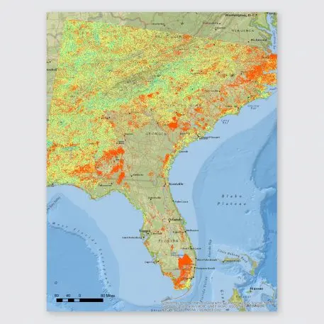
By the middle of the century, as climate change progresses, extreme flooding is likely to increase across some southeastern U.S. states. AT&T, which has to deal with the immediate aftermath of any storm when phone service goes out, now knows where flooding is more likely–down to the level of each neighborhood.
The company worked with Argonne National Labs to make a detailed, three-decade model of some of the worst impacts of climate change–inland flooding, coastal flooding from sea-level rise and storm surges, and high-intensity winds–in North Carolina, South Carolina, Georgia, and Florida. The data was overlaid with AT&T’s maps of its own infrastructure, from copper lines to cell sites, creating what the company calls a climate change resilience tool.
“It helps us anticipate the impact of severe weather on our networks, and on our operations up to 30 years into the future, and that obviously gives us a chance to adapt and become more resilient,” says Charlene Lake, the company’s chief sustainability officer and senior vice president for public affairs.
“Historically, we’ve always kind of known through local knowledge what areas are more prone to flooding than others,” says Scott Mair, the company’s president of operations. “But what’s new with this new tool is I can now look 25 to 30 years into the future, and anticipate where that flooding will be . . . the decisions we’re making today are going to be better decisions because I can protect those boxes in a more effective way.”
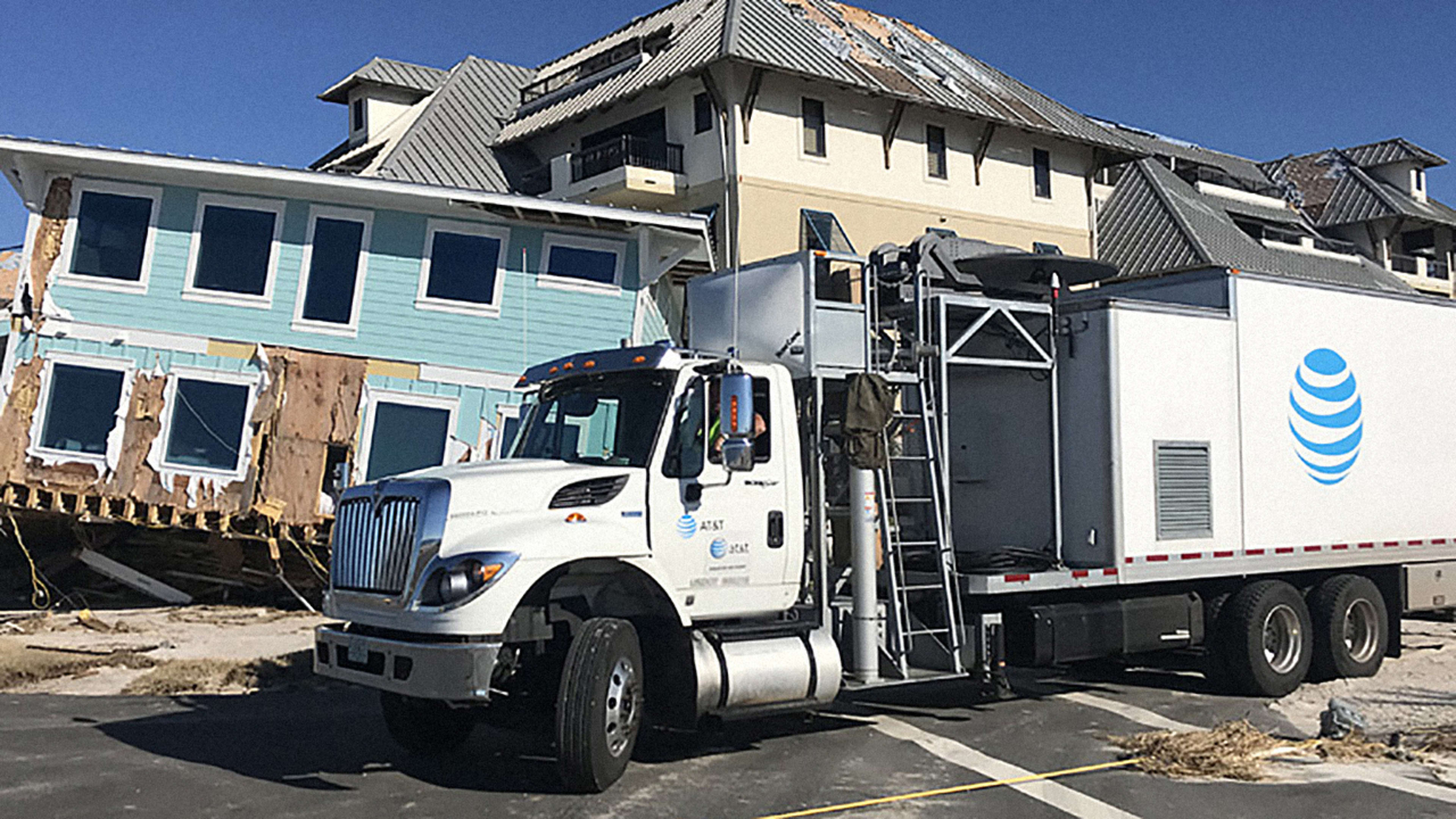
Infrastructure built today could last 25 or 30 years, which is one reason why it’s critical to plan at least that far in advance. The tool can also be used to help the company plan where disaster response teams and other resources should be located. The company is also beginning to use new disaster-response tools–after Hurricane Michael, for example, it used drones that can restore wireless connectivity from the sky, and it also uses mobile cell sites on trucks that can quickly bring temporary connectivity back to an area within an hour. But it would be better if its infrastructure were simply more resilient and could simply withstand a storm and keep working.
The pilot focused on four states that are at particular risk from hurricanes and flooding, but the company now wants to run models in other parts of the country and consider other types of disasters, including droughts and wildfires. It’s also working with Argonne on a plan to share the data with other organizations that can also use it for planning. Mapping that level of detail requires supercomputers like Argonne’s; without that tech, simulating just one year of impacts in the four states would have taken years of computing.
“Because climate change affects all of us, and it’s not just an issue for us at AT&T, we think these data sets should be available to those who want them for their own planning purposes,” says Lake. The company hopes to release the data later this year.
Recognize your brand’s excellence by applying to this year’s Brands That Matter Awards before the early-rate deadline, May 3.
