
At long last, that tin-foil hat may come in handy.
Though there’s been a radical increase in government surveillance in the decade and a half since September 11, 2001, the fact is that so-called “spy satellites” are still not capable of doing much more than taking the occasional snapshot (albeit a very high-resolution one) of a portion of the surface of the Earth. While Enemy of the State, the canonical 1998 thriller about the dangers of unrestricted government surveillance, depicted satellite imagery tracking an unwitting Will Smith through the streets and suburbs of Baltimore and Washington, D.C., the reality is that the surveillance satellites of today are simply not up to such a detailed level of real-time monitoring.
But truth is beginning to catch up to fiction, and two companies—one Finnish, one American—are now vying to be first to launch a new kind of satellite constellation that will radically amp up surveillance capabilities, even if they won’t achieve Jerry Bruckheimer-esque levels of scrutiny. What’s more, lower costs will mean that what’s seen by these eyes in the sky will be available to a wider range of customers than current satellite imagery.
The changes are set to have a significant impact on doing business around the globe. Perhaps more importantly, they raise serious questions that will need to be addressed about how we navigate a world in which more information is public than ever before. “We can imagine a series of market-rational decisions that produce a society we really don’t want,” says Neil Richards, an expert on privacy issues and a law professor at Washington University in St. Louis. “That’s my biggest worry.”
Seeing In The Dark
Both Finland’s ICEYE and Capella Space, based in Palo Alto, are scheduled to launch satellites next year that pack a technology called Synthetic Aperture Radar (SAR), a form of radar that can more cheaply scan the Earth’s surface regardless of daylight, cloud cover, or other conditions. While SAR surveillance exists today, it generally rides on satellites the size of school buses, which can revisit a particular spot on the planet’s surface only once every day or two.
But both Capella and ICEYE will put their SAR capacity on cheaply built and launched cube-shaped microsatellites measuring around two feet on a side or less. This will let them each create a constellation of dozens of satellites that can revisit nearly any spot on the planet as often as every hour. “The lowest cost and smallest SAR satellite launched so far is 100 times larger than one we are going to produce,” says ICEYE CEO Rafal Modrzewski.

“Our goal from day one has always been to be able to look at anywhere in the world every hour,” says Payam Banazadeh, CEO of Capella. Banazadeh stresses the difference between “average revisit times,” which may give you four images in an hour and then none for the next three hours, and what Capella has in mind, which is persistent hourly coverage. “For that, it’s just a physics problem,” he says. “You need, at a minimum, 36 satellites.”
Low-cost satellites will mean not only more data, but lower-cost imagery as well. A single high-resolution satellite image can cost anywhere up to $8,000 to cover an area 3.1 miles (5 kilometers) on a side, Banazadeh says. “We want to be below that by an order of magnitude,” he adds.
ICEYE X1 Satellite [Images: courtesy of ICEYE]
High-Value Targets
While lower costs could bring satellite imagery to a broader range of customers, it’s the more frequent revisit times over the entire Earth’s surface that will make the bigger difference, Banazadeh says, “In the next 10 to 15 years, if you don’t have a stream of satellite imagery somehow involved in your operation, you’re obsolete. Everyone else is going to be doing that, and everyone else is going to have that information about the evolving nature of their operation, and about everyone else’s operation.”
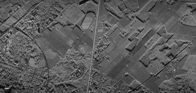
Today, satellite imagery is used for business intelligence on things like activity at ports, capacity utilization in oil tanks, or how many cars are in the parking lots of the world’s malls. But information on most of these things is currently available at most once a day. And since optical satellites can only gather imagery in daylight and clear weather, information about cloudy locations like ports or what shoppers are doing in the evening hours (when a lot of important retail traffic happens) can be spotty at best.
“If you really want SAR imagery of a particular spot, you can probably get that daily right now, if you go to all the different SAR providers and offer them a bunch of money,” says Jimi Crawford, CEO of satellite imagery analytics company Orbital Insight. “You can get high repeats of really high-value targets, but if you want to get very broad swathes—all the oil tanks in the world, all the shopping malls—the capacity is just not there.”
SAR imagery of the Port of Rotterdam, The Netherlands [Animation: MDA Cotp. satellite imagery courtesy of Orbital Insight]
Patterns of Life
Even daily imagery can’t be guaranteed today, because the needs of government or military organizations often take precedence, meaning a satellite may not be pointed where you need it, when you need it. Governments are interested in low-cost SAR imagery as well, to be sure. The Pentagon’s Defense Innovation Unit-Experimental has backed both Capella and ICEYE, though Congress recently turned down a DIUx request to redirect $50 million toward more microsatellite SAR initiatives.
Neither Capella nor ICEYE would comment on their government customers, whether in the U.S. or elsewhere. But expanded monitoring capabilities would obviously be of interest to governments around the world. “For any sort of defense or intelligence application, it’s absolutely critical,” Crawford says. Being able to look at the planet more frequently, in more detail, will not only let governments understand when things like build-up of troops or refugee migrations are happening, but, when combined with the kind of “pattern of life” analytics offered by companies like Orbital Insight, Ursa Analytics, and others, can let them understand when such events may be imminent. Orbital Insights, for instance, has used such analysis to look at retail trends, making some very accurate predictions based on car counts in mall parking lots.
SAR iamgery of a New York parking lot. [Animation: MDA Corp. satellite imagery courtesy of Orbital Insight]Autonomy will also be a big part of such analysis. “You might want to have a mechanism in place that says, if this competitor moves at least five trucks into this area, then alert me,” Banazadeh says. “Enabling a world where you can have much more transparency not only into your own operations, but also into everyone else’s, I think that will help everyone.” The new crop of SAR satellite and analytics companies all want to give customers the kind of information that improve their decision making. But along with the trucking example, one can imagine a mechanism that says, if this country moves at least five trucks into this area, then launch a missile. Will that help everyone? It’s hard to say.

Round The Clock
Crawford says the new generation of spy satellites won’t be able to track your individual pattern of life. “There’s no way you can track a person,” he says. “Even a car, you can tell a Mini from a Hummer, but trying to identify a Toyota versus a Hyundai? Give it up. We’re tracking patterns. We’re looking at how many cars are in the Walmart, not whether John Smith is in the Walmart.”
One thing SAR imagery can help with is humanitarian applications, including getting a more accurate assessment of floodwaters. Orbital Insight also has an ongoing project with the World Bank to use high-resolution satellite imagery to help measure poverty in places in Mexico and Sri Lanka.
The Capella and ICEYE constellations will move us closer to 24/7 monitoring of the entire surface of the Earth, a state that Crawford says we could reach as early as the next five to 10 years. And satellite surveillance is only one piece of the puzzle in terms of monitoring systems, of course. As surveillance capabilities expand and become more widely available, the world will soon find itself in unfamiliar territory in terms of how best to navigate that terrain.
“As we develop these technologies, and particularly as we commercialize them, it’s important to think about the medium- to long-term consequences of using them,” says Washington University’s Neil Richards. He continues:
For observational technology, it is probably unregulated government access that I worry the most about. What’s important is that we have conversations up front before mass deployment of these technologies, so that we can understand what our values are and what values we want to build into these technologies. At the bottom line, information provides power. We’ve known this for centuries. And digital technology running on information provides even more power. We want to be thoughtful about the way we allow power to operate in our society, so that we have the kind of society we want to live in, and not some sort of science fiction dystopia. The reality is going to fall somewhere between those two extremes.
So will that tin-foil hat really be enough? Time will tell.
Mark Wallace has written for the New York Times Magazine, Wired, Salon, and many others. He lives in San Francisco.
Recognize your brand’s excellence by applying to this year’s Brands That Matter Awards before the early-rate deadline, May 3.
