Data from the Sentinel-1A satellite is providing insurance companies and the Indian government objective proof of land damage in the Tamil Nadu region’s worst drought in 140 years.
So far, data from Sentinel-1A has been used to assess the validity of around 200,000 insurance claims, and over 10,000 farmers have received payouts.
Tamil Nadu, a state in southern India, is living through its worst drought in 140 years. Even during the monsoon season last year, rainfall was scant, smattering just a handful of areas and leaving the land cracked and dry. In the state of 68 million people, there are around one million rice farmers for whom the drought has proved disastrous; yields have suffered, and more than 254 farmers have committed suicide since last October.
Without another source of income, the farmers turn to insurance payouts to last through the year. The Agriculture Insurance Company of India was founded in 2002 to offer yield-based and weather-based insurance for over 500 districts in India. If a farmer’s crops fail for a season, or if their land is too dry to plant, the insurance company will reimburse the farmer for damages. But without objective data to back up their claims, farmers can struggle to receive compensation commensurate with the damage to their lands.
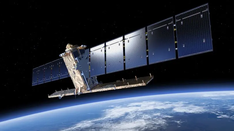
The Sentinel-1A satellite carries a radar sensor that can capture roughness and moisture of crops on the ground. [Image: ESA/ATG Medialab]A new satellite program launched in collaboration with theEuropean Space Agency(ESA) is providing that much-needed objectivity, and speeding up the process by which farmers are approved for payouts. Initially launched in 2014, the Sentinel-1A satellite has been delivering data for use in crop insurance in India since summer 2016, when the drought began to take hold.
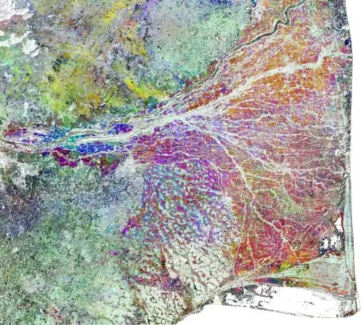
“Due to radar wavelength, data can be acquired day and night and also in cloud conditions.” [Image: ESA/RIICE/TNAU]The Sentinel-1A satellite carries a radar sensor that can capture roughness and moisture of crops on the ground. “Due to radar wavelength, data can be acquired day and night and also in cloud conditions,” says Michael Anthony, project director for theRIICE consortium, an international public-private partnership advancing the use of sensor-based satellites for crop insurance programs in emerging economies, which is overseeing the Sentinel-1A program in India. “This is crucial because the growth of rice plants normally happens during rainy season,” he tellsFast Company. Satellites equipped with optical cameras struggle to collect adequate data because clouds and poor lighting obscure image quality.
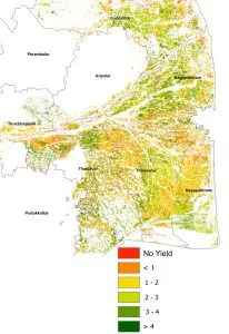
The Sentinel data speeds up the process, and does away with the need for farmers to back up their claims of crop failure or land damage–the satellite imagery tells the story for them. [Image: ESA/RIICE/TNAU]Sentinel doesn’t deliver data directly to the Agriculture Insurance Company of India; rather, it feeds the radar images to several intermediaries, including the Tamil Nadu Agricultural University, which processes the data, and the Tamil Nadu Department of Agriculture. Working with the University and the Department of Agriculture, the insurers can identify the areas in which rice sowing failed or farmers were unable to plant altogether, Anthony says; in those cases, farmers are eligible to receive up to 25% of the total sum insured for their plot. So far, data from Sentinel-1A has been used to assess the validity of around 200,000 insurance claims, and over 10,000 farmers have received payouts. The Sentinel data speeds up the process, and does away with the need for farmers to back up their claims of crop failure or land damage–the satellite imagery tells the story for them.
While Sentinel-1A data will continue to help farmers in Tamil Nadu access insurance payouts, RIICE is also operating in other countries like Thailand, Vietnam, Cambodia, and the Philippines, where the International Rice Research Institute is developing a way to use the data to estimate rice yield over the course of a season; it’s also proven useful to assess damage from floods. Especially as climate change makes events like floods and droughts both more unpredictable and more extreme, access to objective data to ensure farmers receive adequate and speedy compensation will be critical.
Recognize your brand’s excellence by applying to this year’s Brands That Matter Awards before the early-rate deadline, May 3.
A refreshed look at leadership from the desk of CEO and chief content officer Stephanie Mehta
Eillie Anzilotti is an assistant editor for Fast Company's Ideas section, covering sustainability, social good, and alternative economies. Previously, she wrote for CityLab.More