Space is a lot closer than it used to be. Companies like Planet and Spire are sending more satellites into orbit than ever before, providing an unprecedented near-real-time view of of every corner of the earth, from wheat fields in Egypt to glaciers in Antarctica. Here are five ways that companies are using this constant stream of data and images to bring more transparency and efficiency to different industries here on the ground.
Agriculture
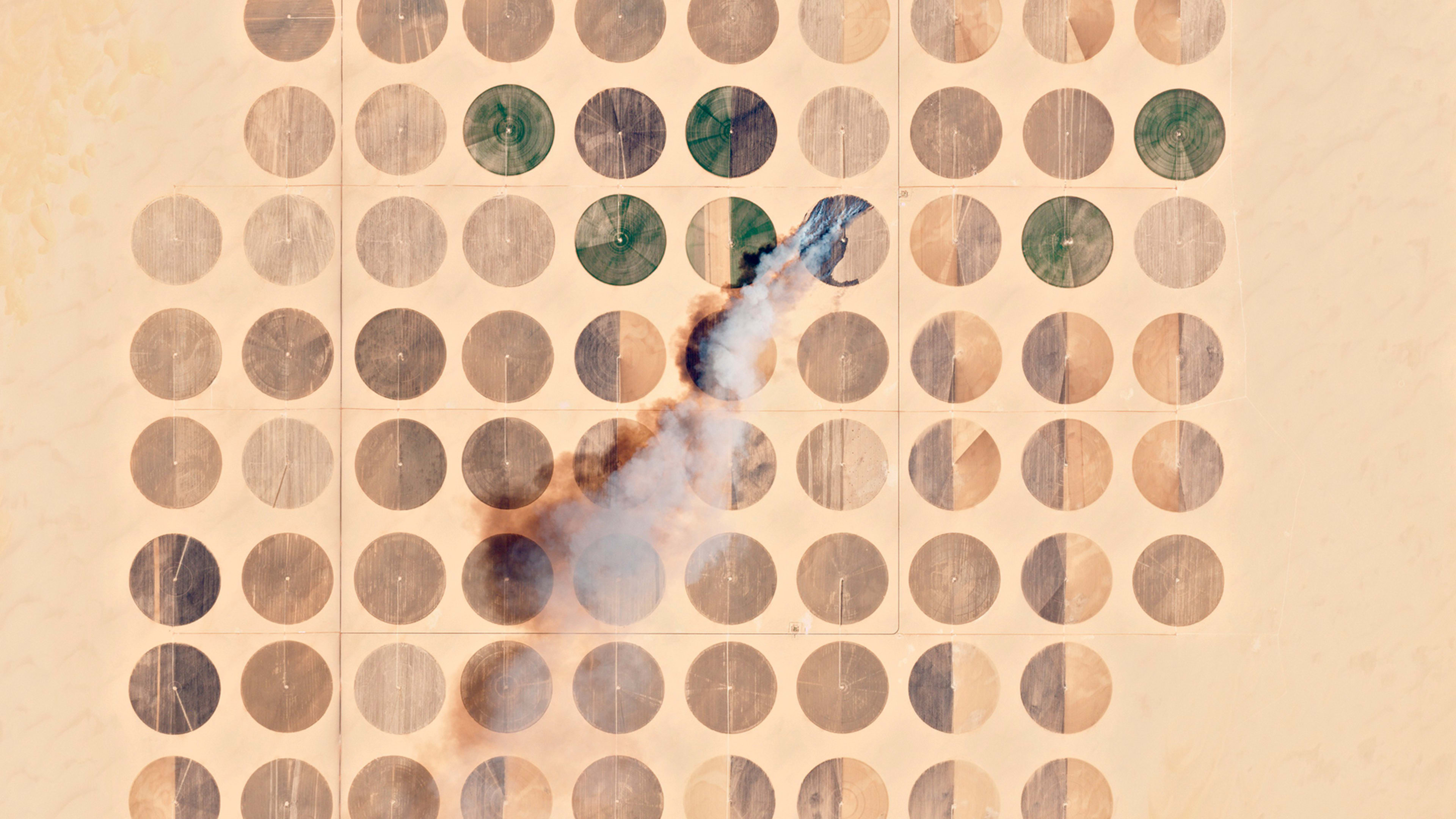
A number of companies use satellite imagery to predict annual farm yields—mostly focusing on major crops like wheat, corn and soy—and produce estimations that are useful for farmers and commodities traders alike. But Vinsight, a small startup in California, has decided to instead focus on grapes and almonds, two of the state’s most valuable agricultural products. “Even the U.S. Department of Agriculture doesn’t forecast those crops,” says founder Megan Nunes. “We thought it made sense to apply the technology to a sector that really needs it.” Grape and almond farmers typically see a 30-40% error rate when they predict their seasonal outputs, Nunes says. With Vinsight’s technology, which uses machine learning to analyze satellite images, taking into account external factors like location, weather, and historical performance, farmers can get a yield prediction that is three or four times more accurate. That information, says Nunes, can help them save on labor costs, estimate their revenue for the year, and strike better deals with buyers.
Another analytics company, FarmShots, digs even deeper. The North Carolina–based startup analyzes specific fields and patches of farmland, studying factors like light absorption and land elevation to detect the presence of pests or diseases on individual fields. FarmShots alerts its clients when there’s a problem, and is currently building out its recognition algorithms to easily identify the cause, such as fungus or trapped rainwater. Through a recent partnership with John Deere, the company’s technology has been built into tractors and other equipment, so those findings can automatically direct machines on the ground. “You don’t want to put on an even coat of fertilizer,” says FarmShots CEO Joshua Miller. “We generate a map to instruct the machine to put less fertilizer on the areas that are healthy and more on the areas that are unhealthy.”
Shipping
Before the era of CubeSats, government-owned satellites tended to cover only the more populated areas of earth—leaving remote corners of the ocean in the dark. Shipping routes in the Arctic, for example, weren’t covered by satellites or signal towers, which led to a dearth of knowledge about who was passing through and what they were doing. In March, Spire partnered with the National Geospatial-Intelligence Agency (NGA) and Ball Aerospace to monitor these blind spots. “The suspicion is that there’s more traffic there than we realize,” says Nick Allain, head of Creative and Brand at Spire. “Whose water are they actually traversing? Where is an oil spill most likely to happen? Are ships meeting in the middle and sharing things they’re not supposed to be sharing?” The partnership will look to gather that information and come up with solutions that prevent black-market trading and make Arctic sea routes safer for shippers.
Recognize your brand’s excellence by applying to this year’s Brands That Matter Awards before the early-rate deadline, May 3.
